
The latest weather radar imagery shows the snow, but this is probably not an accurate rendition of the true state of affairs.
Why? First, snow does not show on radar as well as rain (ice does not scatter microwave radiation as readily as liquid water). But more important, Oregon has terrible radar coverage. I mean bad. They don't have a weather radar on the coast and much of eastern Oregon has zero radar coverage in the lower atmosphere. The eastern slopes of the WA Cascades are not much better.

The folks in Oregon should be up in arms about this--and they need someone like our Senator Cantwell, who pushed for the Langley Hill radar on our coast.
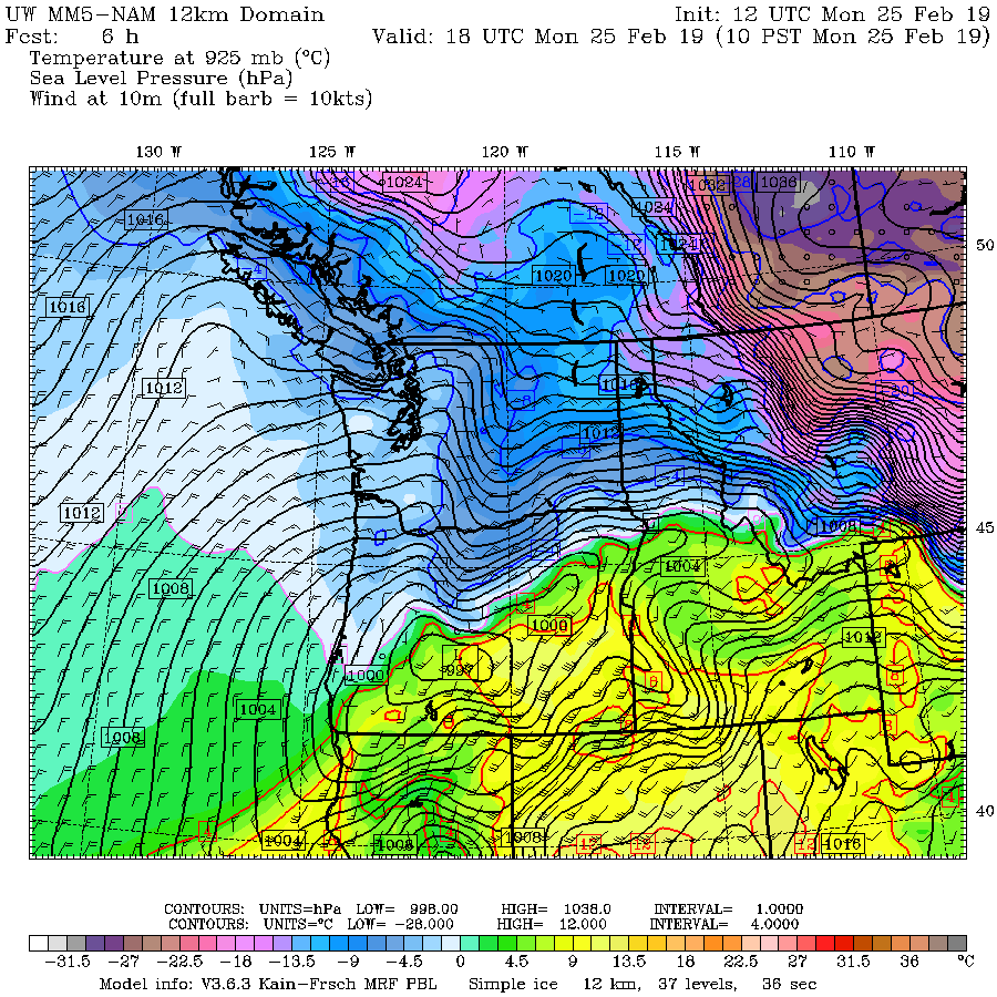
A six-hour forecast of sea level pressure and low-level (2500 ft) temperatures for 10 AM today predicts the low center will be over the southern Oregon Cascades at 10 AM ( see below). Very cold air is over BC and eastern WA, with simply cold air over western WA and NW Oregon. Extremely cold air is found over central and eastern Montana, illustrating how the Rockies protects us from the really primo cold stuff.
Snow will not get near Puget Sound, but central Oregon will be buried. Here is last nights UW WRF model forecast for total snowfall for the 48 h ending 4 PM Tuesday. In Washington, Walla Walla will get a piece of it, but the real action will be south of Salem. You will not want to go to Eugene, which will resemble Siberia before this over.

This snowfall is really a gift from the weather gods for Oregon. A month ago, there was substantially below-normal snow pack over the Oregon Cascades. By the time it is over, Oregon will have a normal snowpack. Very good news for water resources, fish, and the ski industry..
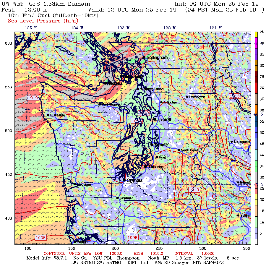
Here in western WA the weather story the next few days will be dry, cold and windy. Cold, dry northeasterly flow is now pushing through the Fraser River valley into NW WA, with gusts to 30 mph and more as I write this (see surface map below). With a strong pressure difference across the Cascades, gusty easterly flow is now descending into the Cascade foothills from Enumclaw to North Bend.

A dry, partly sunny, but cool week is ahead. Will we end up with the coldest February on record at Sea-Tac? It will be soon time to run the numbers!

from Cliff Mass Weather and Climate Blog https://ift.tt/2E8wxOu
No comments:
Post a Comment