Model forecasts were quite good, particularly in describing the substantial local variations in strong winds. As shown by max gust map below, winds got to 60 mph at Sea Tac, along the coast (e.g., Hoquiam) and in the central Strait of Juan de Fuca.

Strong enough, that even with the "pruning" of past windstorms, plenty of trees and branches were felled. Winds were weaker over western Kitsap county, something the models predicted (see below).

One of the most interesting aspects of the event was the strong surge of westerly winds in the Strait that followed behind the trough of low pressure, something that was well forecast. At the leading edge of the surge there was intense low-level convergence (air coming together), which forced air to rise and produce a line of intense thunderstorms. You can see this on the radar image at 3:29 AM today (Sunday)--see below. The red indicated pouring rain or small hail.

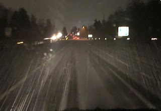
There was report of an amazing deluge and a hail-covered I-5 and adjacent areas (see example)
You think stormfest is over? No way! Look what is lurking off our coast on Wednesday at 4 AM---A HUGE DEEP LOW CENTER.


from Cliff Mass Weather and Climate Blog http://bit.ly/2TypDs6
No comments:
Post a Comment