

24 hour from now (7 PM Friday), a much stronger low-pressure center will be due west of Vancouver Island. The pressure analysis shows an intense pressure gradient (change of pressure with distance) over the offshore waters, which will bring big winds over the water.

The wind gust forecast for the same time are impressive, with 60 knot gusts south of the low. Note winds are NOT strong in the center of the low.

By 4 AM Saturday, the low has moved NW of Vancouver island, with a very large pressure change along the Vancouver Is. coast.

Wind gust are even stronger at that time, but shifted NW with the low.

Some big waves will be forced by the low, up to 9-10 meters high (see plot)

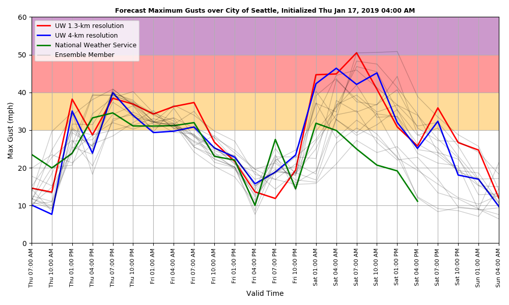
The winds here in Puget Sound will pick up again late tomorrow night as the second low moves by, but there is a lot of uncertainty, depending on exactly the path of the low. Here is a plot of the UW many-forecast (ensemble) system. Winds rev up after 10 PM Friday, but forecasts are all over the place.....will have to wait to have more certainty about the forecast.
from Cliff Mass Weather and Climate Blog http://bit.ly/2sxMfgA
No comments:
Post a Comment