The MODIS satellite imagery around noon showed very dense smoke over eastern WA and the north Cascades, with lesser but substantial smoke now over northwest Washington, with a thinning from Seattle southward.
The 2PM image from the GOES geostationary satellite, indicates the smoke is slowly moving southward west of the Cascade crest.
The backdrop of Seattle is getting murkier over time.
As of noon, air quality was moderate over the Puget Sound area, except for rapidly worsening conditions at Darrington (see below)
Unfortunately, if our models are correct, low-level air quality is about to get much worse. The NOAA/NWS HRRR smoke model prediction for near-surface smoke showed high values (red-purple) over the Cascades and eastern WA at noon (1900 UTC)
By 5 PM it is moving into Puget Sound
And fully entrenched at 5 AM Monday. These forecasts are for higher concentrations than in the forecasts for last Wednesday, our last big smoke day.
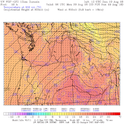
By 11 PM, moderate NE winds will be blowing smoke right into us.
And easterly flow will be in place at 11 AM Monday....pushing the smoke our way. Not good.
So get rid for a major smoke event. No, I am not going call it Smokezilla.
from Cliff Mass Weather and Climate Blog https://ift.tt/2L676i9


No comments:
Post a Comment