the smokestorm.
And tonight and tomorrow one will hit western Washington, with air quality degrading rapidly to levels that may even be worse than Wednesday of the past week. Vulnerable folks need to be prepared for this onslaught of smoke.

Large fires are now burning in British Columbia and eastern Washington, injecting substantial smoke into the air. With generally westerly flow aloft during the past few days, western Washington has been protected, but the winds aloft are turning northerly and northeasterly, resulting in the smoke blowing directly towards us.
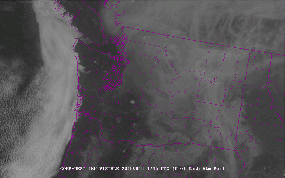
The visible satellite image around 10 AM Saturday shows lots of smoke over eastern WA and southeastern BC that is extending to the Cascades and even NW Washington. Animations show this smoke moving directly towards northwest WA. Low clouds are evident along the coast.
High resolution models predict increasing northeasterly and easterly flow aloft, bringing the smoke into us. Let me show you the current forecasts from the NOAA HRRRSMOKE system for the next 36.
First, vertically integrated smoke (total smoke in a vertical column). Red indicated large values and purple is extremely high.
At 5 AM this (Saturday) morning, all is good in western Washington, but high values loom to the north and east.

By 5 PM Saturday, smoke is really moving into NW Washington.

By 5 AM Sunday most of western WA is covered with some very high values extending into northwest Washington from the fires on the other side of the Cascades.

Even worse by Sunday at 5 PM.

Now that is vertically integrated smoke....smoke that makes the sun dim and hazes out our views. Much of this smoke is aloft. What about smoke at the surface? Let's take a look!
5 AM Saturday--a little haze but nothing serious.

Things are getting worse by 5 AM Sunday, particularly above roughly 1000 ft.

And substantial smoke reaches the surface by 5 PM Sunday.

Although HRRR smoke only goes to 36h, I suspect things will get much worse on Monday. The UW WRF model predicts strong easterly/northeasterly flow at 2 PM Monday (see map at 850 hPa--about 5000 ft). The gunk will be streaming over the mountains right into us. Not good.

Monday could be an extremely smoky day and I expect that my colleagues in the National Weather Service will put out an air quality alert today. They won't use the term smokestorm, but the threat to vulnerable folks will be serious. One exciting aspect of the recent smoke events is the quality of our new smoke models and our ability to warn folks of such serious, health-challenging events. If you can't stop the fires, you can at least warn folks about the smoke impacts and allow them to take protective steps.
Finally, an excellent place to go for real time air quality information here in Puget Sound is the Puget Sound Clean Air Agency. The EPA AirNow site is also excellent.
from Cliff Mass Weather and Climate Blog https://ift.tt/2OJUzD6
No comments:
Post a Comment