Here are the max. gusts during the past 24h (only gusts greater than 31 mph are shown). Lots of gusts into the 40s mph around Seattle and 50+mph in the Strait and northern Whidbey Island. Some exposed locations in the Cascades hit 70-80 mph.

Several thousand customers lost power around the region, but nothing serious.
Now the next story is the passage of a warm front through the region tonight and tomorrow morning. Here is the forecast sea level pressure, 925 hPa (roughly 3000 ft) temperature (shaded), and winds for 1 AM Sunday morning. I have indicated the warm frontal zone with the blue oval. (click on image to expand).
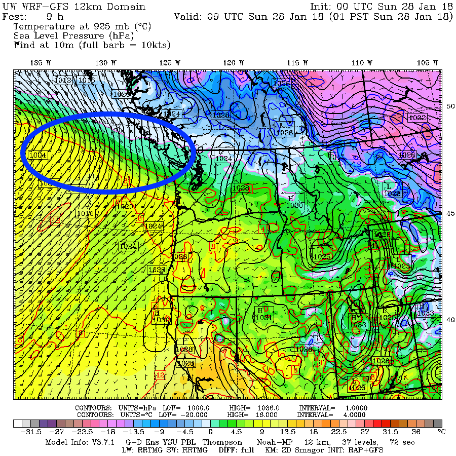
Look closely and you will see that the warm frontal zone is associated with a major temperature change, with warmer temperatures to the south. Wind direction shifts and the front is associated with lower pressure (a trough). This feature is moving north, so we will be transitioning to warmer air


The trouble is that the systems we get tend to be old ones, with their origins well to the west of us. So we generally experience aging occlusions, and not nice warm fronts like the one that is passing up our coast tomorrow AM.
We will get substantial rain as the front moves through Sunday morning, but things should dry off to the south by mid-day. But feel sorry for the poor folks in southern BC--the warm front will stall there and there should be lots of precipitation over Vancouver Island and the southern BC mountains.
To illustrate, here is the 24 hour total precipitation ending 4 AM Monday. 5-10 inches of rain along the Vancouver Island coast. The Olympics and northern Cascades will catch a piece of this. Whistler's lower slopes will be a swamp.

from Cliff Mass Weather and Climate Blog http://ift.tt/2GnHThL