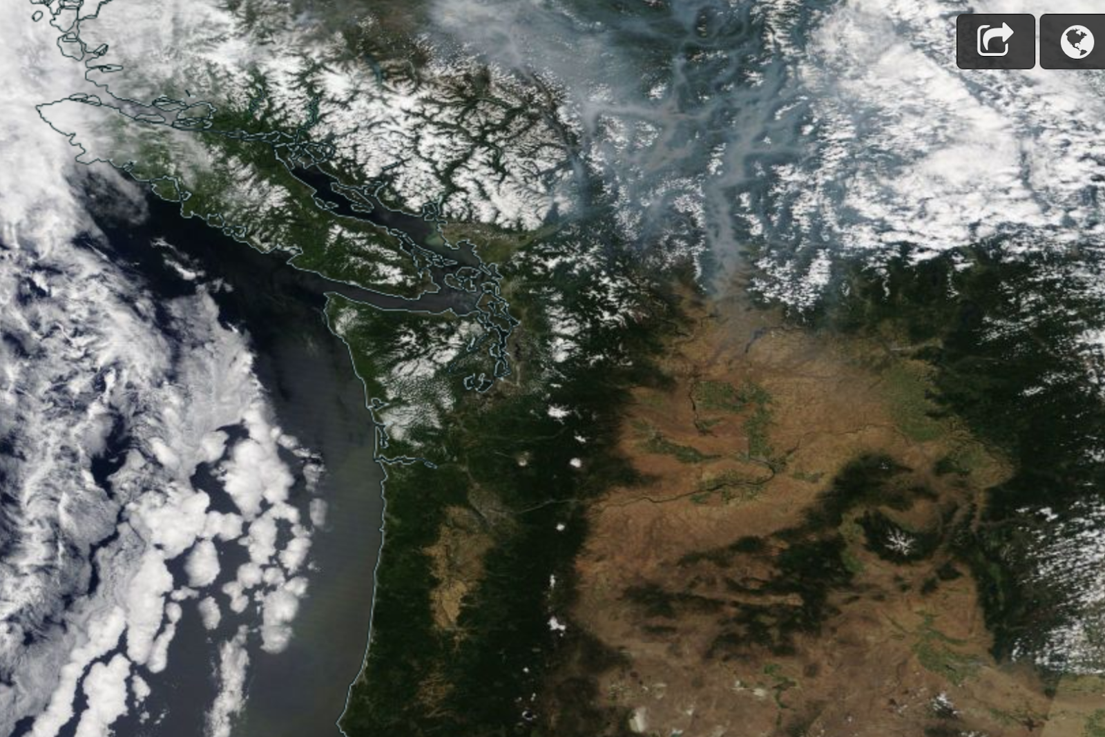
Let's start by comparing the high resolution MODIS satellite imagery for yesterday around noon and the same time one year ago (below). This year, with the exception of some clouds, has clear skies with little hint of smoke.

But last year, dense smoke, produced by multiple fires over British Columbia, was evident over that province, with substantial amounts pushing into Washington State.
Air quality, as shown on the EPA AirNOW website, is quite good over our region today(see below).

Why has this year been better?
We started with a healthy snowpack on April 1st, which is good. But the key has been that June had normal to below normal temperatures around the region (see below). And, precipitation, and particularly thunderstorms, were below normal--thus, less lightning initiation of wildfires.

Because of the good snowpack and a relatively temperate spring (except the warm period in May), the soil and fuel moistures are relatively normal right now over fire-prone areas, with the biggest dry anomalies over the western part of the region, which is far more resistant to fires. To show this, here is the current Palmer Drought Severity Index, which integrates past temperature and precipitation to give a measure for the moisture content of surface layer. Not too bad over eastern Oregon and Washington.


The forecasts over the next week are favorable. We should be dry, but not excessively warm, with highs getting into the lower to mid 80s over western Washington. The latest ensemble forecasts indicate high pressure building over the West Coast, but of modest amplitude (see forecast height anomaly--difference from normal--at 500 hPa from the GEFS ensemble below).

We will be dry....but paradoxically that could be a good thing in the short run, with no thunderstorm and lightning activity over the Washington and much of Oregon. The UW WRF accumulated precipitation for the next week is shown below. Only southern Oregon will get some lightning... and the fire folks need to be ready for that.

So what about new fires in the weeks ahead?
It will be up to us. The moisture content of "fuels" will slowly drop, enhancing fire danger. And it is clear from the recent grass/sage brush fire near Vantage that some of the grasses at lower to moderate elevations are ready to burn right now. So we have to be careful (no fireworks, no throwing lit cigarettes out of cars, no target shooting, campfires, and off-road vehicles in vulnerable locations, etc.)
But we should not forget that fire is entirely natural in our region and much of the problem is created by us. We are pushing our homes deep into the wildland--locations that have burned frequently for millennia. We have mismanaged our forests, including suppression of fires and allowing them to grow into explosive tinderboxes. And we should never endanger young men and women to save isolated homes when wildfires are raging.

For too long, many in the media and some politicians have waved the climate change banner when wildfires have occurred, neglecting to push the necessary actions on the ground (e.g., stopping development in remote areas, thinning and burning forests). My field can help immensely by providing forecasts of dangerous situations (like major wind shifts, upcoming lightning events), but in the end some difficult and expensive choices need to be made.
from Cliff Mass Weather and Climate Blog https://ift.tt/2zErF4S
No comments:
Post a Comment