Pages

Thursday, January 10, 2019

Death and Destruction on Snoqualmie Pass: Time for WSDOT to Make Better Use of Weather Information

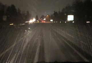
Last Friday morning, icy road conditions caused a series of accidents on both the eastbound and westbound lanes of I-90 near Snoqualmie pass, resulted in the closure of a crucial east-water transportation corridor for hours and one death.


The fatal collision occurred when four tractor-trailers and a pick-up truck collided on eastbound I-90 around 5 AM near milepost 62, on the eastern side of the pass.  As a result, the eastbound lanes were closed for 13 hours! 

The westbound accidents involved three semis and three cars near milepost 61 and closed the pass for 6 hours.

The location of the accidents are shown in the map below (red marker at Milepost 62)   Note that the accident site is about 10 miles east of Snoqualmie Pass in a relatively low area of the Yakima river drainage.  Keep this in mind...it will be important.


Roadway icing conditions were reported in the area.  Let's explore why.

The meteorology of the situation is no mystery.    Cool, near freezing and subfreezing air over eastern Washington pushed up the Yakima Valley/ I-90 corridor to near Snoqualmie pass, while warmer air was aloft.

A plot of the surface air temperatures (typically 2-meters above the surface) at the time of the accidents (around 5 AM), shows 31F in the area of the accident.   And temperatures at the surface could have been a few degrees cooler than that.  And near freezing temperatures were found down the valley towards Cle Elum.


Temperatures were actually warmer above the valley, since cold air was trapped at lower elevations.

What about precipitation?  To get some insight into this, let's check out the nearby (but higher) Stampede Pass weather station, located at roughly 4000 ft (I-90 near the accident site was at about 2400 ft).  It was dry at Stampede Pass until 10:48 PM (0634 UTC), followed by a wintry mix of rain, snow and ice pellets.  Precipitation was over by 2:49 AM.  Note that the air temperatures were a few degrees warmer at Stampede Pass than at I-90.


Local weather radar is consistent with the Stampede Pass record and showed a band of precipitation moving through late the previous evening and during the early morning hours (see radar imagery below for 9:01 PM and 11:43 PM the night before).


Importantly, this band of precipitation was forecast skillfully the day before,  as indicated by the UW WRF model (the 21h forecast for the 3-h precipitation amount ending 1 AM Friday)


So we had freezing temperatures at the surface and precipitation falling into it, with an icy mixture of cold rain, snow, and ice pellets falling into the cool air near the surface.  An obvious threat.

Now, I would not be surprised that the drivers involved in these accidents were driving too fast for the conditions.    But there is SO MUCH WSDOT could do that could help prevent such accidents, but to do so WSDOT needs to use weather data in a much more proactive way.

For example, with temperatures below freezing on that roadway section and precipitation moving in, WSDOT could reduce the speed limit on that section (perhaps 35-40 mph).  That can easily be done with the electronic signage installed along the freeway.  Push people to slow down.


Time and time again there are similar incidents with extensive accidents, loss of life, and extended periods of closing the pass when sudden inclement weather comes in.  Weather conditions THAT ARE ENTIRELY FORESEEABLE with modern weather observations and modeling.

Another example is the situation on the western side of the Snoqualmie pass April 2nd of this year in which the pass was not only closed, but a pregnant woman and her unborn child were killed.  This heavy snow event was caused by a predictable convergence zone and its evolution was clearly evident on weather radar.  The speed limit could have been greatly reduced BEFORE the accident occurred, hopefully preventing it.

And such predictable highway weather disasters are found all over the State, like the freezing rain that caused a Husky Band bus to overturn on the way to the Apple Cup.


Pre-emptive actions to slow traffic and prevent accidents is critical, because once accidents start to occur, plowing becomes nearly impossible and the pass or roadway has to be closed for hours to clear up the mess, before the plows can go to work.

WSDOT Needs to Build the Capacity to Use Weather Data Better

In 1970, there were only a few dozen real-time weather observation locations in our state.  Today, there are thousands.  In 1970, weather forecast models had no ability to predict local weather.  Today, we have extremely skillful high-resolution forecasts, some updated every hour.  Today we  have excellent weather satellite coverage, where there was nearly nothing available in 1970.  Same with radar coverage.  In 1970 it was difficult to communicate to folks on the road.  Today, with electronic signage and smartphone apps, information can be transmitted in real time.


Weather information and forecasts are now so skillful that WSDOT needs to change the way it does business:  not reacting to weather situations but acting proactively.    With a modest investment, WSDOT could build the capacity to access state-of-the-art weather information and forecasts to build warning systems that would save lives and radically reduce the number of pass closures. Speed limits could be reduced as a matter of course when inclement weather is imminent.   And keep in mind that such a proactive system would not only save lives, but have major economic benefits, since pass/freeway closures are extraordinarily costly for our state, with losses of many millions of dollars per day when Snoqualmie pass is shuttered.

Unfortunately, WSDOT management is not only NOT investing in such systems, it has been going in the wrong direction.   When offered such capabilities, they expressed little interest in using weather data in this new way, and recently dropped funding for the state-of-science weather communication tools they were supporting, like the I-90 and Ferry Weather pages shown below.


Building a modern weather warning system for Washington State roadways would pay for itself in one event. 

Perhaps if Washington citizens let their elected officials and WSDOT management know that the current situation is not acceptable, better use of weather information on our roadway will occur. 


from Cliff Mass Weather and Climate Blog http://bit.ly/2QHm2WQ

Tuesday, January 8, 2019

Huge Storm Offshore

A huge, deep midlatitude cyclone is parked off our coast right now, with very strong winds over the Pacific and large easterly flow in the Columbia Gorge, the Strat of Juan de Fuca, and within east-west passes in the Cascades.

The sea level pressure forecast for 1 PM is impressive and huge, with the low center spread over much of the NE Pacific, with a deep 974 hPa low center due west of the CA/OR border.


The latest visible satellite image illustrates the large scale of the storm, a very long cold front, and the cold, unstable air circling into the low center.


The moisture imagery (white showing lots of upper tropospheric water vapor) shows the vast amount of water vapor spiraling into the storm.


This large pressure gradient associated with the storm is producing strong winds over the ocean, with gust forecasts over the ocean show areas reaching 40-70 mph at 1 PM today.

 As the low slowly drift towards us, the strong winds will reach the Oregon/Washington coastline (see gust forecast for 10 AM Wednesday).

A huge, slow-moving storm has strong winds, lots of fetch, and plenty of time for the wind to work on the water.  The result are big waves, something predicted by the NOAA WaveWatch3 system: (9-11 meters high shown by orange colors below)

With a low offshore and higher pressure offshore, local winds are accelerating from east to west in our regional gaps.  For example, winds are quite strong in the Strait of Juan de Fuca (see forecast for 1 PM below).

And easterly winds are accelerating over the western side of the Columbia Gorge:


from Cliff Mass Weather and Climate Blog http://bit.ly/2FgR1a2

Huge Storm Offshore

A huge, deep midlatitude cyclone is parked off our coast right now, with very strong winds over the Pacific and large easterly flow in the Columbia Gorge, the Strat of Juan de Fuca, and within east-west passes in the Cascades.

The sea level pressure forecast for 1 PM is impressive and huge, with the low center spread over much of the NE Pacific, with a deep 974 hPa low center due west of the CA/OR border.


The latest visible satellite image illustrates the large scale of the storm, a very long cold front, and the cold, unstable air circling into the low center.


The moisture imagery (white showing lots of upper tropospheric water vapor) shows the vast amount of water vapor spiraling into the storm.


This large pressure gradient associated with the storm is producing strong winds over the ocean, with gust forecasts over the ocean show areas reaching 40-70 mph at 1 PM today.

 As the low slowly drift towards us, the strong winds will reach the Oregon/Washington coastline (see gust forecast for 10 AM Wednesday).

A huge, slow-moving storm has strong winds, lots of fetch, and plenty of time for the wind to work on the water.  The result are big waves, something predicted by the NOAA WaveWatch3 system: (9-11 meters high shown by orange colors below)

With a low offshore and higher pressure offshore, local winds are accelerating from east to west in our regional gaps.  For example, winds are quite strong in the Strait of Juan de Fuca (see forecast for 1 PM below).

And easterly winds are accelerating over the western side of the Columbia Gorge:


from Cliff Mass Weather and Climate Blog http://bit.ly/2FgR1a2

Sunday, January 6, 2019

Windstorm Details

Well....my power did go out last night, as it did for roughly 300,000 power customers in western Washington.

Model forecasts were quite good, particularly in describing the substantial local variations in strong winds. As shown by max gust map below, winds got to 60 mph at Sea Tac, along the coast (e.g., Hoquiam) and in the central Strait of Juan de Fuca.


Strong enough, that even with the "pruning" of past windstorms, plenty of trees and branches were felled.  Winds were weaker over western Kitsap county, something the models predicted (see below).


One of the most interesting aspects of the event was the strong surge of westerly winds in the Strait that followed behind the trough of low pressure, something that was well forecast.  At the leading edge of the surge there was intense low-level convergence (air coming together), which forced air to rise and produce a line of intense thunderstorms.  You can see this on the radar image at 3:29 AM today (Sunday)--see below.  The red indicated pouring rain or small hail.


There was report of an amazing deluge and a hail-covered I-5 and adjacent areas (see example)


You think stormfest is over?   No way!    Look what is lurking off our coast on Wednesday at 4 AM---A HUGE DEEP LOW CENTER. 

Expect strong winds offshore and some good size waves.... NOAA's Wavewatch 3 model is predicting about 8-9 meters at that time (26+ ft).

So reset your clocks, clean up the debris, and keep tuned.

from Cliff Mass Weather and Climate Blog http://bit.ly/2TypDs6

Windstorm Details

Well....my power did go out last night, as it did for roughly 300,000 power customers in western Washington.

Model forecasts were quite good, particularly in describing the substantial local variations in strong winds. As shown by max gust map below, winds got to 60 mph at Sea Tac, along the coast (e.g., Hoquiam) and in the central Strait of Juan de Fuca.


Strong enough, that even with the "pruning" of past windstorms, plenty of trees and branches were felled.  Winds were weaker over western Kitsap county, something the models predicted (see below).


One of the most interesting aspects of the event was the strong surge of westerly winds in the Strait that followed behind the trough of low pressure, something that was well forecast.  At the leading edge of the surge there was intense low-level convergence (air coming together), which forced air to rise and produce a line of intense thunderstorms.  You can see this on the radar image at 3:29 AM today (Sunday)--see below.  The red indicated pouring rain or small hail.


There was report of an amazing deluge and a hail-covered I-5 and adjacent areas (see example)


You think stormfest is over?   No way!    Look what is lurking off our coast on Wednesday at 4 AM---A HUGE DEEP LOW CENTER. 

Expect strong winds offshore and some good size waves.... NOAA's Wavewatch 3 model is predicting about 8-9 meters at that time (26+ ft).

So reset your clocks, clean up the debris, and keep tuned.

from Cliff Mass Weather and Climate Blog http://bit.ly/2TypDs6

Saturday, January 5, 2019

Major Wind Event For Western Oregon and Washington

A major wind event is now probable for western Oregon and Washington, potentially the strongest windstorm so far this winter.

Very strong winds, with gusts to 50-80 mph, will move up the Oregon coast this evening and then pummel western WA in the morning hours, ending with a powerful surge of westerly winds in the Strait.

This is serious, so I would be prepared (batteries, don't drive around during strong winds, etc.).  There will be power outages.

The 8 AM GOES-17 weather satellite imagery shows the storm west of northern CA and southern Oregon (you can see the swirl of the clouds).

And the sea level pressure forecast for 10AM this morning suggests an elongated area of low pressure associated with the storm, with an area of very large pressure change (gradient) to its south. THAT is where the strong winds will be.


By 10 PM tonight, the area of large pressure change moves along the northern Oregon Coast, bringing very strong winds from Seaside down to North Bend.


Three hours later (1 AM Sunday) the hyper pressure gradient reaches southwest Washington.


And by 4 AM has pushed over Northwest Washington, including Puget Sound.


I will now show you the output of the UW high-resolution ensemble system, probably the best regional ensemble system in the U.S. (this is the kind of system I have been trying to convince the National Weather Service to do nationally).   The graphic is from the Seattle WindWatch website, by the way (and was create by UW Research Meteorologist Jeff Baars).

This graphic shows the maximum wind gust forecast over Seattle from a large number of high-resolution forecast runs.    Wow.  I am charging my smartphone immediately!  Nearly all of the forecasts are going for a significant event (gusts over 40 mph) and several have gusts over 50 mph! The timing of the peak winds vary a bit (between roughly 1 and 7 AM).
Now let me give you a more spatial view, showing the 4-km resolution WRF run made at the UW this morning. 

At 10 PM tonight (Saturday), really strong winds (blue and brown colors) are hitting the northern Oregon coast (up to 65 knots, about 75 mph!)


By 1 AM, the WA coast is being savaged by 50+ knot gusts, and strong winds are just reaching Olympia.


One hour later, Puget Sound is in the crosshairs of mother nature, with up to 60 kt gusts reaching south Seattle.   Big winds continue on the coast.


At 4AM, winds have decreased slightly over Puget Sound, but an extraordinarily strong westerly wind surge has pushed into the eastern Strait of Juan de Fuca, northern Whidbey Island, and the southern San Juans.   We are talking about 60 knot gusts.


In short, it is highly probable that this will be a major wind event.  Perhaps not the equal of the truly historic storms (eg., Chanukah Eve and Inauguration Day Storms), but quite possibly the big wind event of the winter.   The only thing that will help mitigate the power outages is the pruning by previous wind events.  But I expect that tens of thousands will lose power over the region.

Now back to charging all my electronic gear.

from Cliff Mass Weather and Climate Blog http://bit.ly/2RzoClY